GUERRERO
(G-GAP projects. Sismologia, IGF UNAM, LGIT Grenoble, France)
|
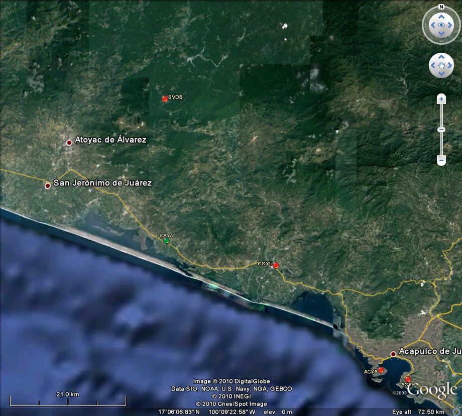
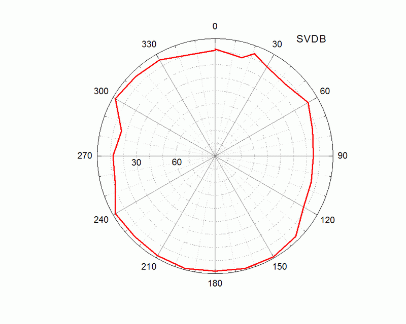
SVDB log file Station horizon mask Data Plot New Permanent Station Form |
Longitude: 100° 17' 0.4319" W (-100.2835) H: (Ell. Height) 927.724 m |
 |
 |
|
|
|
 |
 |
|
|
|
 |
 |
|
|
|
|
SVDB log file Station horizon mask Data Plot New Permanent Station Form |
Longitude: 100° 17' 0.4319" W (-100.2835) H: (Ell. Height) 927.724 m |
|
|
|
|
|
|
|
|
|
|
|
|
|
|
|
|
|
|
Acknowlegment:
Installed by Jorge Real, Juan Payero de Jesus and Vladimir Kostoglodov,
April 29, 2010.
We thank Sr. José Alfredo Sánchez Abraham (comisario
de San Vicente de Benitez) for the help and permission for the
GPS installation.
Caseta telefonica del pueblo: 555-1515019
<<
BACK