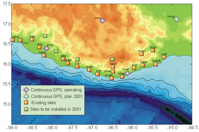
20 new sites of the Oaxaca-Guerrero
GPS network were occupied in March-April 2001, each site for 3
days.
The records from continuous GPS stations in Pinotepa Nacional
(PINO),
Oaxaca (OAXA),
and Huatulco (HUAT)
will be used as the reference for a differencial data processing.
13 sites in the central part of the Oaxaca have
been occupied in July 2000 for 4-24 hours. These data will provide
some preliminary estimates of the crustal
deformation along the coast of Oaxaca.
Photo of the Oaxaca GPS team, 2001.