Our seismotectonic studies along the Pacific coast of Mexico during the last few years have resulted in the discovery an extremely "slow" or "silent" earthquake on the plate interface of the Guerrero seismic gap. Sudden rupture of this gap may produce a catastrophic earthquake of magnitude Mw>8.0. The discovery of the "slow" earthquake is based on very accurate long-time geodetic measurements obtained with our new network of global positioning system (GPS) stations. The silent event began in October 2001 and lasted for about 6 months. The slow slip occurred over an area of ~250x200 km2. The modeled average slip on the interface was about 15 cm and the equivalent magnitude, Mw, was ~7.5. In contrast, an ordinary Mw7.5 earthquake lasts for about 15 seconds, ruptures an area of ~55x55 km2, and involves an average slip of ~200 cm. A few silent earthquakes (also called transient slips or "aseisms") have been recently reported in other subduction zones but the last Guerrero slow event is unique in that it is probably the largest reliably detected so far anywhere in the world and extends over an astonishingly large area. The discovery of this slow event has far reaching implications for our understanding of the rheology of the plate interface, the earthquake cycle and the source process. Our study calls for a reassessment of the seismic potential and a seismotectonic monitoring of the Guerrero and other seismic gaps in Mexico.
Our discovery can be summarized by the 3D hypsographic image of the subduction zone in Guerrero, shown below, where the velocities of the GPS sites for the interseismic steady-state motion (yellow vectors) are compared with those during the last 2001-2002 silent earthquake (red vectors).
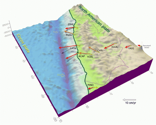
Astonishing change in the plate crustal motion from the interseismic phase to the slow silent earthquake peak phase occurred at the end of 2001 over the entire Guerrero State. In the figure open yellow arrows denote relative (subduction) velocities between the oceanic Cocos and continental North American plates. Violet line is the administrative boundary of Guerrero.
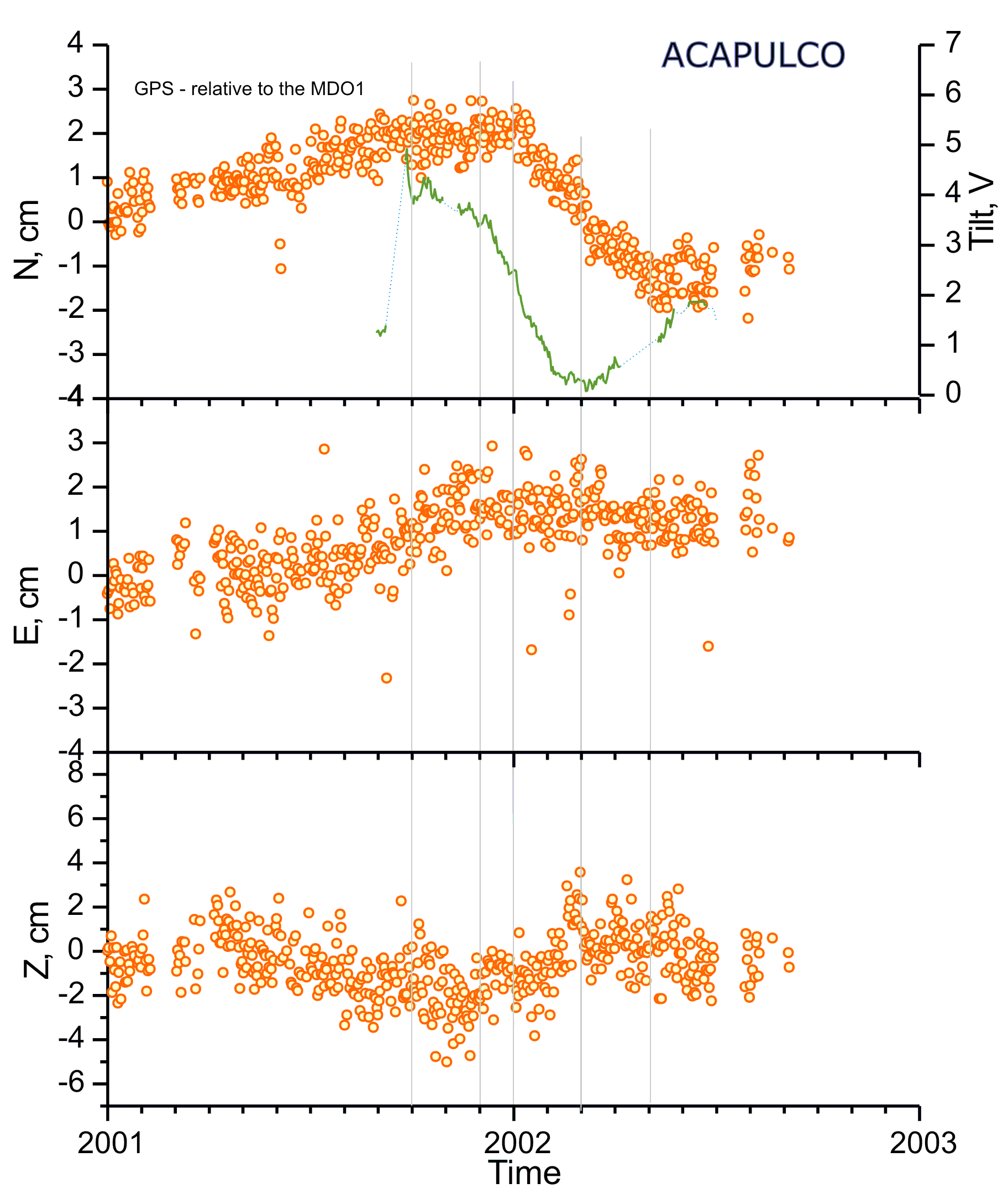
Time series of the Acapulco continuous GPS station (circles) and the tilt signal obtained with the LBT (green line). The tilt signal (V) shows several distinct phases of the slow slip, which were not seen in the GPS record.